
Home / Site Design + Construction / Site Analysis + Planning: Soil Smart Designs
Highlights
Why Do This Step?
Pre-development analysis and assessment are foundational steps in ensuring soil health and ecological integrity during the design and construction process. Practices for assessing site conditions include observation, mapping, and soil testing. A comprehensive understanding of existing site conditions greatly informs the strategies that will best protect or enhance soil health during and after construction, ensuring better outcomes for vegetation, water management, and carbon storage.
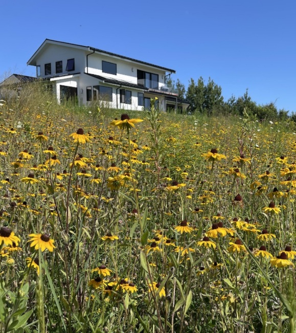
While remote analysis offers valuable information, in-field observation is the best method to establish soil health baselines and identify areas needing protection from disturbance. Source: RDG
Site Analysis & Assessment
Typically, there are two phases to site analysis and assessment. The first phase involves learning about the site remotely using pre-existing information that is available online or in existing records. The second phase involves a site visit armed with the knowledge gained from remote analysis, along with any maps, materials, and equipment needed for in-field assessments.
The information gathered will be used to:
- Create a Soil Protection and Management Plan,
- Provide a baseline for restoring the soil to pre-development conditions (or better),
- Determine appropriate remediation strategies during or after the project is complete,
- Compare remote datasets with actual soil conditions onsite, and
- Detect any soil deficiencies or contamination from past use.
Remote Soil Analysis
SSURGO Soils Data and Mapping
The USDA’s Natural Resources Conservation Service (NRCS) Soil Survey Geographic Database (SSURGO) provides crucial data and maps for understanding the current soil conditions across a site, including characteristics like texture, structure, and drainage capabilities. SSURGO data and mapping are available on the NRCS Soil Survey website (NRCS, 2019). By leveraging SSURGO data, design teams can assess the suitability of soils for various development activities, identify areas of high soil function, and locate regions where soil regeneration practices may be necessary. The database can highlight soils that are vulnerable to compaction, erosion, or other forms of degradation, guiding the development of tailored management strategies.
If the site has already been disturbed by previous activities, SSURGO data can also provide a baseline soil profile as a reference point for rehabilitation post-construction. For many urban and peri-urban sites, soils can be dramatically altered from their past conditions due to the impacts of construction and land use over time. In some cases, the context of development can result in historic soil profiles no longer being suitable for restoration due to anticipated use or performance requirements (e.g. sports fields, roadways, etc.).
Review of Mapping
Review other types of mapping for the site in question, such as USGS topographic mapping, National Wetlands Inventory mapping, MassGIS data layers (including MassGIS wetland data), FEMA floodplain mapping and data, Natural Heritage & Endangered Species Program mapping, aerial imagery, and any existing site plans or surveys. In some instances, such as for highly disturbed sites, historic maps and aerial photographs can be useful in understanding the site’s history.
While remote site analysis is an important initial source of information, the specifics of a site may not be well represented beyond a certain scale. Mapping accuracy varies widely from region to region. Some soils data is more reliable in agricultural areas than in urban or forested areas. Other maps may be derived from modeling more than actual surveys. Either way, the most reliable information will always be what is directly observed and gathered onsite.
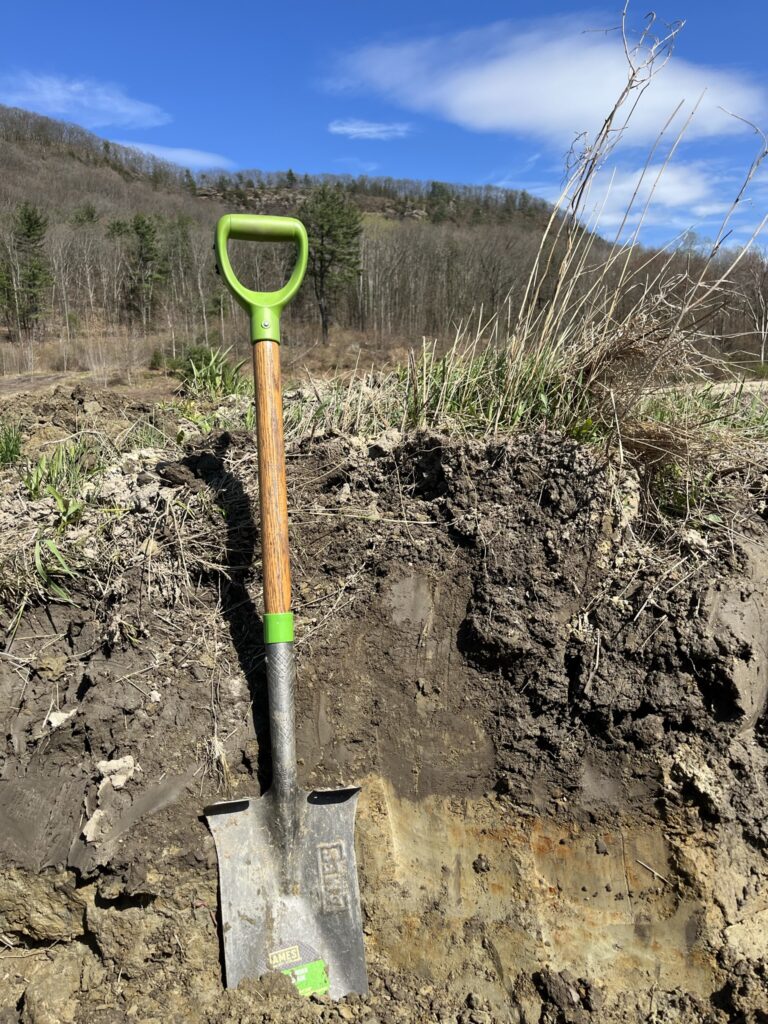
Onsite Soil Analysis
Walk the Site
Before conducting any specific tests, walk around the site to get an overall understanding of the site’s characteristics, such as landscape position relative to adjacent land, water features and wetlands, vegetative cover types, slopes, presence of unusual features, areas of existing disturbance, and presence of invasive species or rare species. In addition to understanding specific characteristics of the site, you will also gain a feel for the land that can be helpful as you engage in more specific soils-related assessments. A common phrase among soil scientists is, “Get your head out of the hole!” In other words, a full understanding of soils on a site is often not possible without also understanding the larger context and landscape. A few key questions to investigate as you walk the site include:
- Where might there be healthy existing soils?
- What kinds of uses are happening on these soils now, and what are their likely impacts?
- What are the future uses anticipated on this site?
- Where would be representative testing locations that provide indicative results for the overall project?
- Where are there unique disturbances, such as excavations, chemical or salt dumps or stockpiles, or signs of compaction, that should be considered as unique challenge areas?
- Where are there root zones for trees or other vegetation that need to be protected during site construction activities, and what are the soil conditions in those areas? Do they require any unique remediation, enhancement, or protection?
Identify High-Functioning Soils & Regeneration Potential
Look for soils that have not previously been disturbed by human activity (i.e., for construction or agriculture) and prioritize for protection. Additional testing may reveal other soils that have a high regenerative potential due to their organic matter content, nutrient-holding capacity, or proximity to undisturbed sites. Areas with high regeneration potential can be managed in ways that enhance soil health, reduce compaction, and encourage biodiversity. Recognizing these soils early in the planning process ensures that they are preserved and fully leveraged for their carbon storage and ecological benefits.
– Existing and potential habitats for threatened or endangered species;
– Forests and mature trees;
– Wetlands & other plant communities with stable hydric soils & aquatic ecosystem buffers; and
– Active farmland.
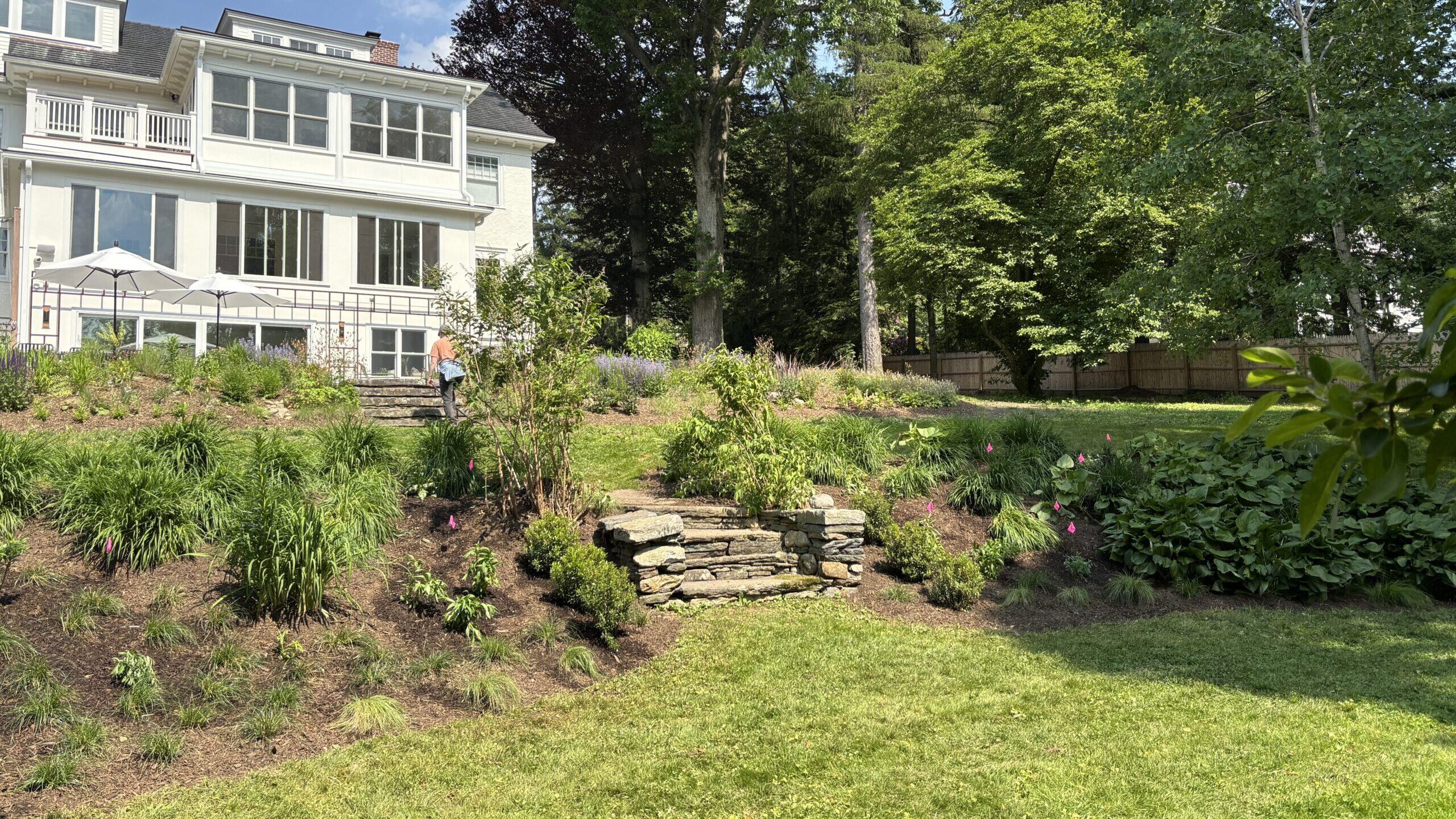
Wherever possible, selectively remove unwanted mature vegetation rather than scraping + replacing whole areas. Image: Sasaki
Contaminated Sites
Many of the soils in and around existing impervious surfaces have been both changed structurally and contaminated by historic land uses. Persistent lead contamination in roadside soils generated from historic vehicle emissions is an example of widespread but low-level contamination. Contamination testing is often focused on known toxic pollutants that impact human health and safety, such as heavy metals, PCBs, VOCs, PFAs, and hydrocarbons. However, contaminants that may impact plant or insect health, but not human health, can sometimes be overlooked. If historic land uses included herbicide or insecticide uses, such as former agricultural lands, additional testing for horticulturally toxic compounds may need to be conducted. Examples of this can include fluorine, PAN compounds, clopyralid, picloram, etc.
In some regions of Massachusetts, there are native soils with heavy metals in them due to the nature of the bedrock parent materials, instead of any human-caused contamination, such as soils in Worcester County with bedrock containing Cobalite that has natural arsenic. In these cases, work with plant communities adapted to those soils and consider sufficient topsoil caping strategies to help ensure plant and human health.
Contamination is a systemic problem in Eastern Massachusetts. The Waste Site Cleanup program at MassDEP is responsible for ensuring timely and effective response, assessment and cleanup of confirmed and suspected hazardous waste sites, according to procedures established in the Massachusetts Contingency Plan (310 CMR 40). When contamination is detected, a site must be certified to be below a certain level of risk, called “No Significant Risk.” If it is above this level, remediation must follow. Commercial and industrial sites have a different threshold than residential areas. MassDEP maintains a searchable database to track the cleanup progress of reported sites and is required to audit response actions at disposal sites to comply with M.G.L. Chapter 21E.
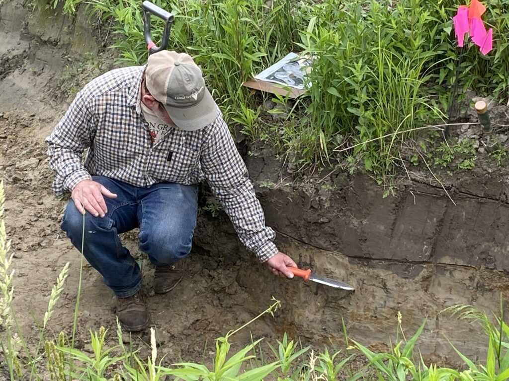
Comprehensive Soil Testing and Assessment
Performing a standard soil chemistry test is not enough to fully evaluate soil health. Conduct a comprehensive soil assessment (see Soil Primer + Assessment Toolkit) to gather necessary additional information about the functional capacity of the soils. Sampling areas should include average representations of the site prior to disturbance, as well as key deviations, such as low-lying areas, areas with notably different vegetation, or areas with particular land-use histories. If the site is already disturbed, include samples from edges or fencerows where disturbance is minimal. It is important to develop both a baseline understanding of the typical conditions on site, the best soils onsite, and areas of particular disturbance or contamination.
Most physical soil characteristics can be assessed onsite with a few simple tools. A lab analysis will reveal areas with imbalanced or excess nutrients that may pollute local waterways, and can verify the presence or absence of heavy metal contamination or excess salts. Samples may be sent to the UMass Soil and Plant Nutrient Testing Lab. Currently, biological microscopy assessments are only available through private soil labs; however, the presence of healthy living soils can still be inferred from physical characteristics and organic matter content.
Interpreting Results
Test results and recommendations from a soils lab are usually developed to optimize plant productivity for commercial agriculture, lawns, or ornamental landscaping. Soil test results must always be interpreted with a clearly articulated goal for the final use of the landscape or site. If the landscape design is targeting the restoration of native plant communities, for example, following conventional recommendations may create an overly nutritious soil with optimal conditions for weeds and invasive plants.
Many chemical amendments and treatments have a short duration in soils and require consistent and expensive inputs to manage the targeted optimal state. If certain characteristics require significant or ongoing amendments to change, it may be easier and more cost-effective to re-evaluate the proposed planting plan to accommodate existing soil conditions. One common example of this is the soil pH. It is extremely difficult to change and maintain the change of soil pH without large and consistent amendments or wholesale replacement. Instead, select plants and plant communities that are adapted to the pH to simplify the project and increase long-term success.
Significantly disturbed soils, such as those with very high salt content, very high pH, or irredeemably compacted (usually with bulk densities above 1.7 g/cm^3) can require excessive mechanical and amendment processes to restore. These soils should be evaluated for health and human safety for use as clean fill, and be replaced within the rooting profile with healthy imported soils.
There are many different ways to approach soil health that may not require inputs at all—a potential cost-savings. Long-term management strategies that reduce compaction and prioritize a healthy soil microbiome are the most effective ways to ensure optimally functioning soils for carbon sequestration, productivity, ecosystem services, and long-term sustainability.
Hydrological Assessment
Stormwater recharges groundwater, supports soil moisture, and maintains wetlands and waterways. However, high velocity stormwater runoff erodes and damages soils, which negatively impacts downstream wetlands and water bodies. A hydrological assessment involves mapping water flow patterns, watershed areas, and identifying potential wetland areas and other sensitive receptors. By evaluating these dynamics, design teams can create stormwater solutions that maximize infiltration, reduce runoff, and protect water quality.
Green infrastructure—like bioswales, rain gardens, and permeable pavements—can provide sustainable, ecologically responsible stormwater management and other ecosystem benefits such as pollinator habitats. They also lower the elevated temperature of impervious surface-dominated areas, known as the heat island effect. Green strategies can be easier and less costly to maintain than traditional grey infrastructure if they are designed and managed well.
The key components of a hydrological assessment are:
- Mapping surface water flow, watershed areas, and wetland and other sensitive receptor locations to assess potential water-related impacts.
- Mapping depth to water table, depth to restrictive layer, and likely seasonal fluctuations of wet areas.
- Assessing infiltration rates to determine where green infrastructure, such as permeable pavements or rain gardens, can be integrated.
Vegetation & Biodiversity
A site’s existing vegetation and biodiversity provide critical insights into the ecological health of the area and its relationship with soil. Understanding the flora and fauna inhabiting the site helps inform design decisions that aim to preserve or enhance biodiversity through plant selection, habitat creation, and minimizing ecological disturbance.
The key components of a biodiversity assessment are:
- Mapping the location of key vegetation that characterizes main features of the sites (e.g., mature trees, established plant communities, socially significant plantings)
- Identifying and mapping native species and the presence of any rare or endangered plant species or animal habitats
- Identifying vegetation and wildlife in multiple life stages. This indicates higher quality habitat and can lead to higher biodiversity.
- Assessing the presence and impact of invasive species on soil health and wildlife habitat
Slope Stability & Erosion Risks
Mapping slope stability and erosion risks is necessary for preventing soil loss, polluting nearby waterbodies, and ensuring the structural integrity of the development. Areas with steep slopes and fine-grained, homogeneous, sandy, or fragile soils are particularly vulnerable to erosion, especially after disturbance from construction. Understanding the site’s topography and erosion-prone areas allows for the strategic placement of retention systems and erosion control measures. Evaluating slope stability and minimizing steep slopes and slope lengths can also help mitigate soil erosion risks.
Interim protection measures, such as silt fences, can mitigate erosion during construction; long-term abatement may include planting slope-stabilizing groundcovers and applying mulch. Design strategies that seek to prevent erosion altogether use a holistic approach to manage topography and overland waterflow to slow and control water movement. This includes considering the unique soil characteristics, such as percolation rates or the potential for developing hydrophobic conditions when dry.
Design & Planning
To the extent possible, the site analysis and assessment of existing soil conditions should inform the architectural and developmental design. This way, limited amendments can be used along with minimal soil disturbance. Where that is not feasible, and the necessary functions of the site exceed the capacities of the existing soils, more extensive interventions can be planned to ensure healthy soil functions while still accomplishing the goals of the design.
Even in conditions where wholesale import of manufactured soils makes the most sense, how excavated existing soil and aggregate materials are used, processed, and reused or relocated can have a range of environmental impacts. Understanding how to optimize these materials for use as potential road base, clean fill, horticultural subsoils, or clean fill, can reduce construction waste and transportation emissions. In all cases, having a Soil Protection and Management Plan in place will facilitate a “soil smart” development.
Developing a Soil Protection and Management Plan
A Soil Protection and Management Plan consolidates the findings of the site analysis and assessment phase to create a map and an accompanying plan. Creating a Soil Protection and Management Plan enables designers and contractors to observe, assess, and protect soils and vegetation well in advance of site preparation. Including this plan in construction documents, along with detailed drawings of specified best management practices and sections for final grading, creates a legally binding contract that clearly communicates the goal of maximizing soil health to the general contractor, excavators, landscape designers, and the client(s).
At a minimum, the Soil Protection and Management Plan will:
- Include a scale drawing of the construction site that illustrates where Vegetation and Soil Preservation Zones, and Critical Root Zones, will be retained and undisturbed
- Locate disturbed soils, and detail with notes, drawings, and sections how soil management strategies will be applied during excavation, stockpiling, backfilling, and final grading
- Identify Soil Restoration Treatment Zones, and determine which methods will be used to restore or enhance soil function
- Specify the methods for soil stockpiling and the amendment procedure
- Specify materials and standards for blended manufactured soils or soil amendments
- Specify any soil blends that will be used to replace disturbed soils
- Contain volume calculations of imported soils, compost, and mulch
- Include copies of laboratory analyses for any imported soils to be used that meet established topsoil or fill quality standards
Key Definitions
Soil Management Strategies
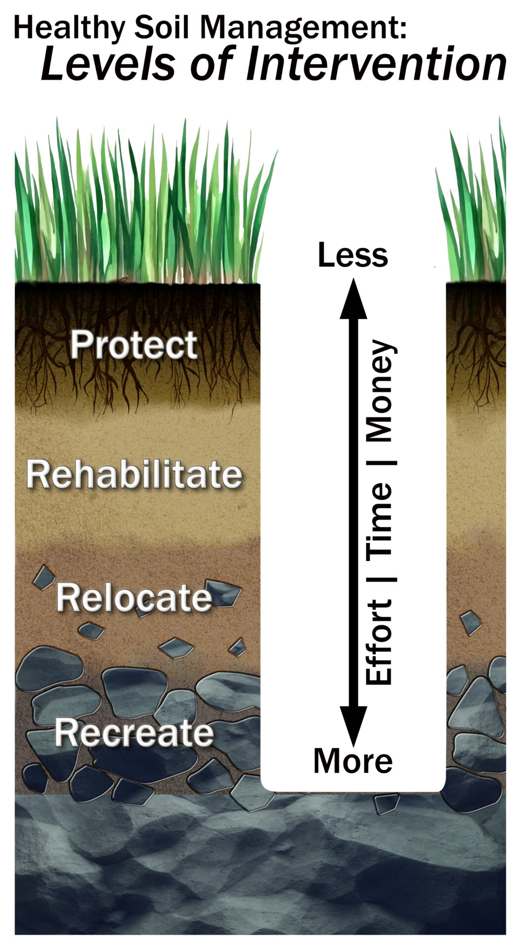
A typical construction project may utilize several strategies on the same site to achieve the highest overall standards of soil health both during and after construction. A key part of developing a Soil Protection and Management Plan is determining which soil management strategies to apply in different areas or stages of the construction process. These strategies can also be considered as varying levels of intervention, from low cost/low intervention (protect) to high cost/high intervention (recreate).
The four main strategies are:
Rehabilitate soils for better ecological function;
Relocate soils that will be disturbed by construction using best management practices; and,
Recreate soils using offsite mixes and amendments to add to, alter, or replace removed or compromised soils.
Protect
- What and where are the high-quality soils that need to be protected? In order to protect the diversity of soils onsite, areas with high-quality soils should not be disturbed or amended.
To achieve this, you may:
- Identify Vegetation and Soils Protection Zones (VSPZs) and Critical Root Zones (CRZs)
- Include fencing, signage, and access restrictions on design and construction plans. Show these to-scale and include appropriate details.
- Prohibit or limit the use of heavy equipment in designated areas
- Include the extent of roots and canopies (i.e. “projections”) for trees and shrubs onsite preparation and design plans. Root and canopy projections, as well as protection measures, should appear on all construction documents where work may impact VSPZs and/or CRZs.
Criteria for mapping:
- Mature forests and woodlands with high Soil Organic Carbon (SOC)
- Wetlands and hydric soils with critical water retention functions
- Critical Root Zones (CRZs) around large trees and native plant communities
- Farmlands or areas with high regenerative potential
- High-quality habitat features or areas
- Buffer distances (e.g., 50–100 feet) around key ecological areas
Rehabilitate
- Where are the soils that can be rehabilitated for greater ecological capacity? Soils that do not fall under the criteria for protection from disturbance may still benefit from low-disturbance methods to increase soil health and function.
Approaches may include:
- Identify Soil Restoration Treatment Zones (SRTZs)
- Scratch, Not Dig: Light aeration techniques to break up surface compaction while preserving existing soil horizons
- Apply organic amendments: compost and biochar additions to enhance microbial activity and water retention
- Cover crops & mulching: using temporary vegetative cover to stabilize disturbed areas and build organic matter
- Addressing erosion and sedimentation issues
Criteria for mapping:
- Previously disturbed areas with moderate compaction or depleted organic matter
- Soil with some structure remaining but in need of improvement for water infiltration and plant establishment
- Areas where minor disturbance is necessary but can be mitigated through low-impact restoration techniques
Relocate
- Which soils will need to be relocated during construction, where will they move to, and for how long? Some soils will need to be temporarily moved for grading or construction, but can be rebuilt with carefully stockpiled soils onsite and improved with amendments.
Approaches may include:
- Strategic soil excavation and stockpiling with staged removal to preserve structure.
- Amending soil before relocation to improve organic matter, nutrient levels, and the soil’s physical properties
Criteria for Mapping:
- Areas where disturbance is unavoidable but soil is not contaminated or overly compacted
Recreate
- Which soils will need to be replaced or recreated to serve particular functional requirements? Soils that are severely compacted, eroded, or contaminated and cannot be rehabilitated will need to be recreated and replaced by blended or engineered soils.
Approaches may include:
- Blending imported soil with organic amendments to match native soil profiles
- Importing engineered soil mixes for stormwater infiltration or structural support and amending to achieve more holistic soil health goals
Criteria for Mapping:
- Severely compacted or eroded soil areas
- Contaminated soil areas
Planning “Soil Smart” Construction Practices
Planning the following actions will improve the soil health outcomes of a typical construction project using “soil smart” design and planning. The following five basic practices not only protect and promote healthier soils, they also frequently provide cost savings through increased efficiency and reduced post-construction site repair. Detailed instructions for all best management practices (BMPs) can be found in Managing Soils Onsite.
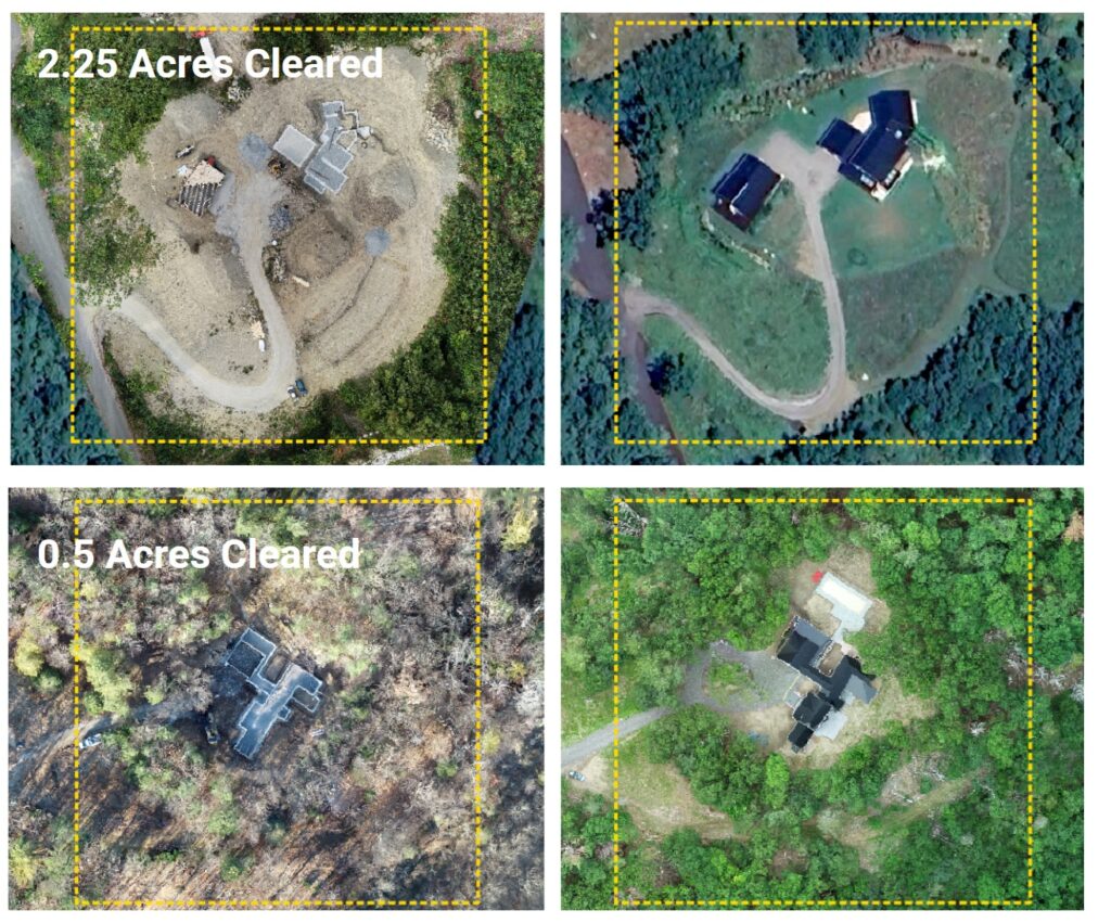
Reduce Construction Footprint
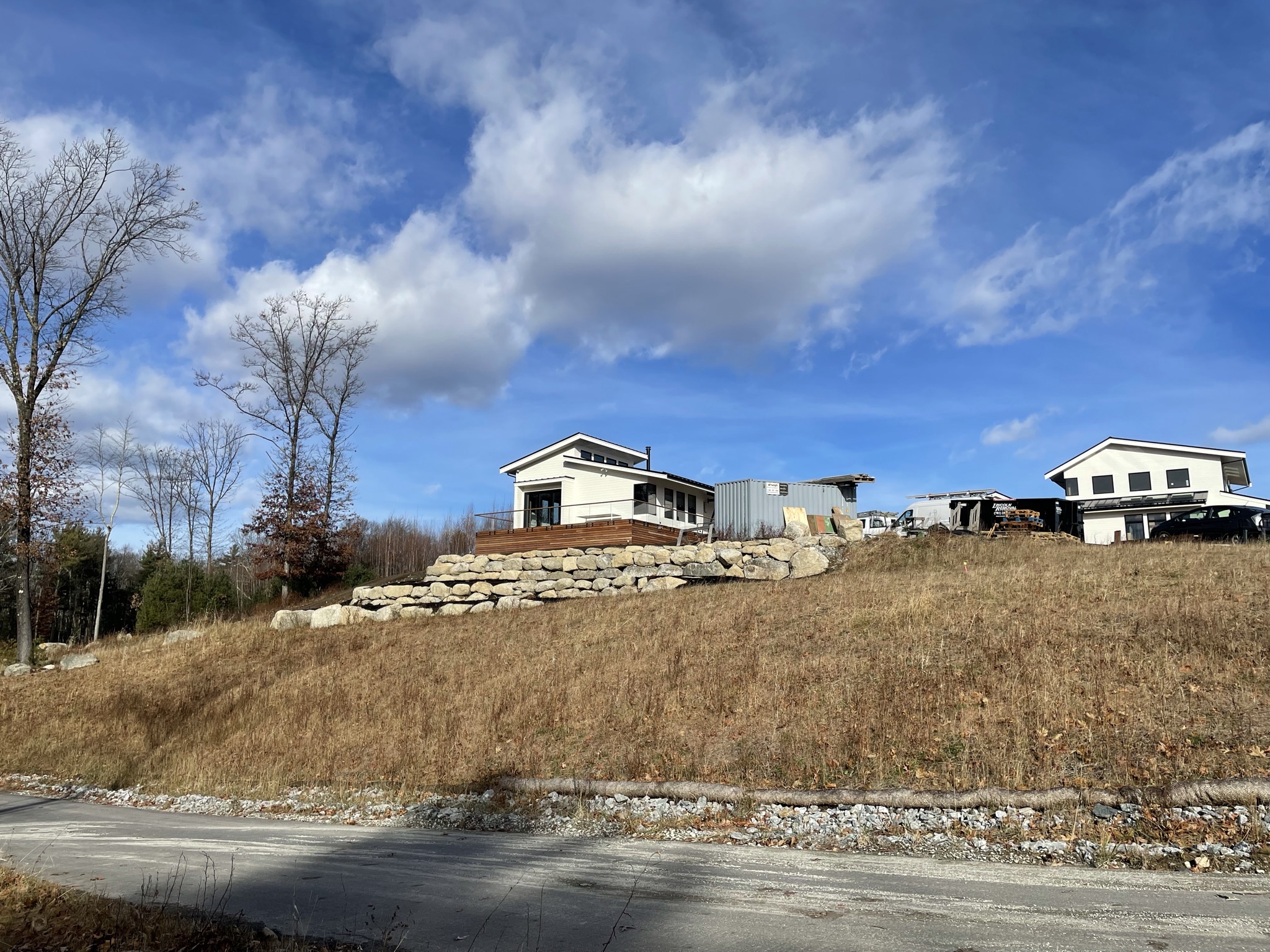
Minimizing the construction footprint to the greatest extent possible will help to protect as much soil as feasible from disturbance, compaction, erosion, and contamination.
If the site of the building itself is not already fixed on the property, prioritize protecting high-functioning soils and locate construction activities on areas with the poorest, or most disturbed, soil(s). Building and deck footprints can also sometimes be reduced through the use of alternatives to standard concrete foundations and slabs, such as piers, cantilevers, towers, and metal screw piles (Mickelburgh, 2023). While these alternatives may require more engineering to implement, they can decrease the amount of construction materials and machinery used, reducing some costs and helping to minimize soil compaction and disturbance.
Define the Area of Work to require as little clearing and disturbance to existing vegetation as possible and prohibit the stockpiling of materials, driving, or storing of vehicles outside of the Area of Work. If possible, specify this boundary and the appropriate access routes in advance of general construction mobilization, and include in the construction documents. A powerful enforcement technique is to include penalties and bonus rewards through the contract documents for preservation and protection areas, such as payment withholding penalties for killing trees earmarked for protection, or bonus payments for passing site protection surprise reviews.
Prevent Compaction
Compaction is one of the most soil-damaging impacts of construction. Compression and shear forces squeeze air out of larger soil pores and, in moist soils, cause the pores to refill with water rather than air. Compaction severely compromises rainwater retention and filtration, exacerbating issues with runoff and drainage on the site. It also reduces the number, activity, and biodiversity of soil microorganisms, preventing efficient nutrient cycling, reducing carbon storage and sequestration, and increasing nutrient leaching and the emission of greenhouse gases. The effects of compaction are difficult to overcome and may persist for decades. Natural decompaction processes such as freeze-thaw cycles, animal burrowing, and root growth only slowly diminish compaction, and are typically limited to the upper foot or two of soil (Randrup, 1997). Even when bulk densities decrease, the original soil structure may not be achieved, especially in soils with clayey soil textures.
Construction documents can specify access paths to and from stockpiles and materials drop-off zones. On loose soil, the first vehicle pass causes the most subsoil compaction. Subsequent passes increase the area and severity of compaction. In most soils, there is little increase in subsoil compaction after four to five passes (Parker et al., 2021). Using narrow and well-defined access roads will limit the compaction caused by construction vehicles to a smaller area and protect more soil onsite. Other ways to prevent and limit compaction include using smaller equipment, decreasing tire pressure, laying down temporary plywood, prohibiting construction activities when soils are wet, and scheduling work with heavy machinery while the ground is frozen. For additional BMPs, see Protect from Compaction BMP.
Soils with high susceptibility to compaction are characterized by having: | Soils that are less prone to compaction include: |
A good representation of a wide range of soil particle sizes — common in loamy and clayey sands and sandy loams | High gravel content soils where the gravel helps support the weight of machinery |
Soil particles that are rounded — coarser sand particles are more likely to be rounded | Cracking clays that are only prone to compaction when wet and are self-repairing |
Low organic matter (usually less than one percent organic carbon) in the topsoil — therefore likely to be a sandy soil | Non-cracking clays are only susceptible to compaction when wet |
Poor soil structure | Shallow soils that are overlying rock or cemented ironstone gravels (ferricrete) at 30 cm or less (this layer supports machinery but will also restrict root growth) |
Prevent Erosion
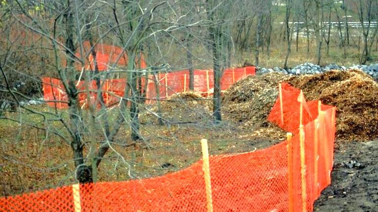
Soil and sediment runoff during typical construction projects can exceed 100-200 tons per acre. Erosion reduces the productive capacity of soils and negatively impacts local and downstream water quality. The primary culprit in construction settings is exposed ground that has been cleared or stripped of topsoil or mounded in poorly-managed stockpiles. Bare ground leaves dirt particles vulnerable to high winds and heavy downpours, both of which are becoming more prevalent with higher intensity storm systems in the northeastern United States.
Eroded landscapes are costly to repair. They cause short-term changes in water quality, such as restricted recreational activities, stressed aquatic organisms, and damaged shellfish beds. Long-term accumulation of sediment and pollutants into receiving waters can create problems that are particularly difficult to correct, such as eutrophication, polluted groundwater, and contaminated sediments (MassDEP, 2003).
Erosion can be controlled using physical barriers such as silt fences, compost socks, sediment traps, erosion control matting, vegetative cover, or terraces. Incorporating slope stability and minimizing steep slopes and slope lengths into the design phase can mitigate long-term soil degradation, save money, and protect valuable ecosystems.
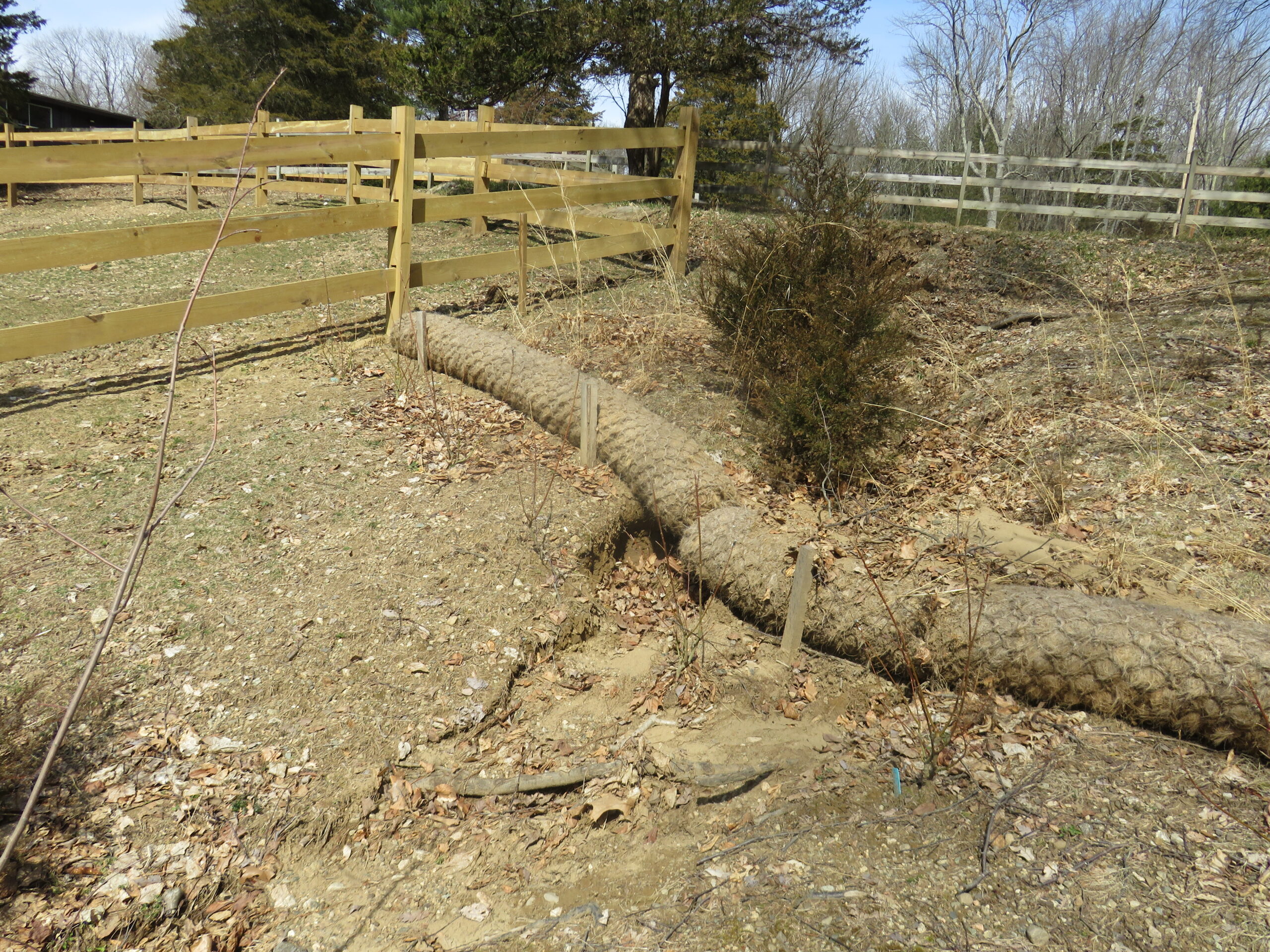
Planned Soil Movement
The only thing worse than moving soil once is moving it twice! In the design phase, consider how and where soil movement will occur throughout the construction timeline. This will protect healthy soils from being buried under stockpiles, reduce further mixing of soil horizons, and minimize the compaction caused by large equipment accessing piles from multiple angles.
Determine an appropriate area for stockpiling that avoids critical root zones, natural hydrological pathways, and sensitive ecosystems. It is essential to select stockpile locations that do not interfere with existing vegetation and biodiversity. Areas that are already disturbed or have low-functioning soils are less likely to be harmed by temporary soil storage. Additionally, areas should be well-drained to prevent erosion and sedimentation issues while ensuring minimal soil disturbance (see Soil Stockpiling). Minimizing stockpile depths, separating soils by horizon, and using temporary cover crops are good practices for large-scale stockpiling projects.
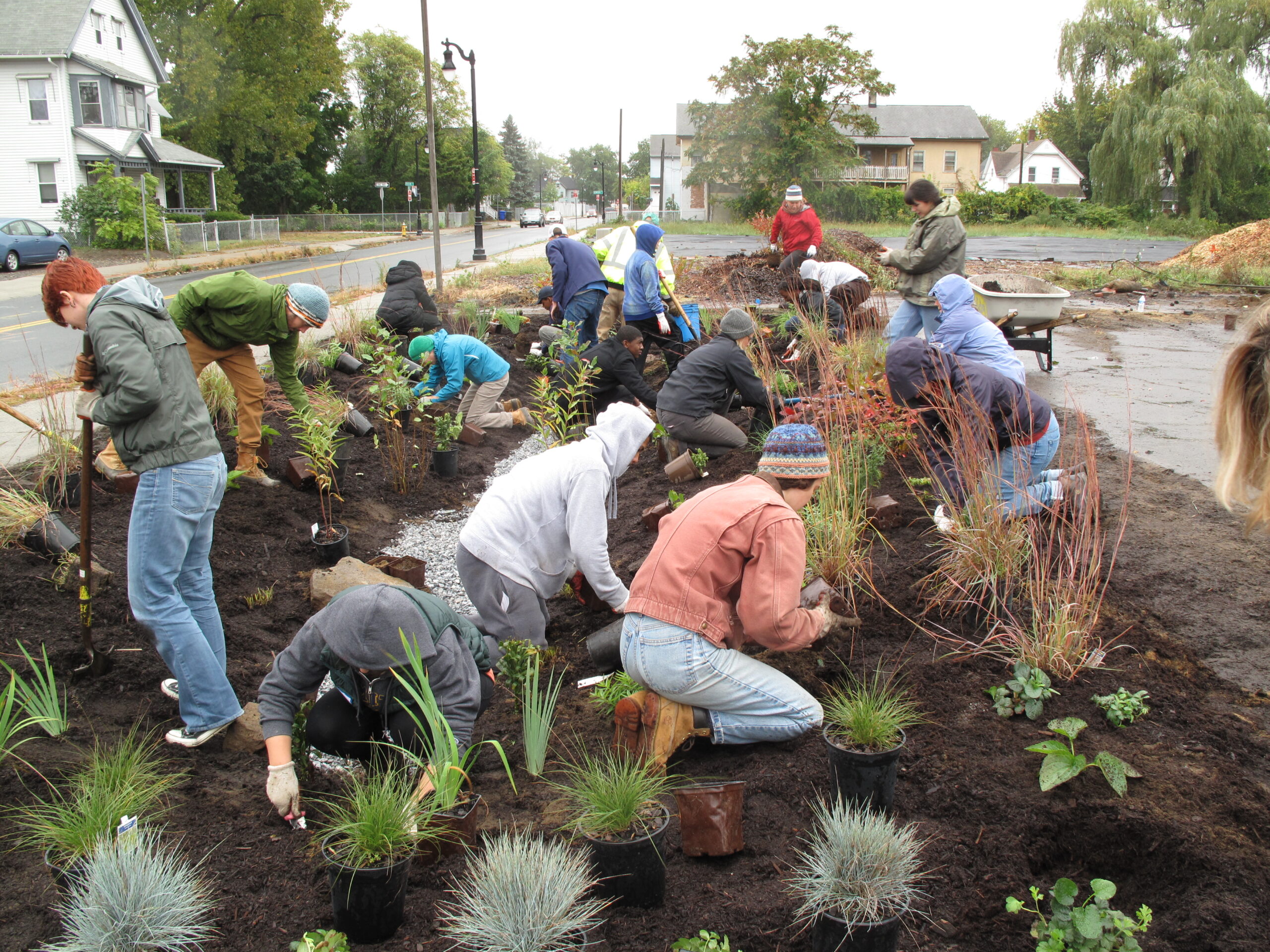
Landscape Design
When comprehensive site analysis including soil testing is conducted in the beginning stages of design, the landscaping can be designed to work with existing conditions. Knowing the location of future planting beds, trees, rain gardens, etc., can help contractors to protect and preserve soil functions in productive areas, prevent subsoil compaction in areas requiring good drainage, and save money with reduced need for soil inputs and amendments post-construction.
Consider as well the impact of landscaping on the site’s long-term ability to capture and store carbon. Imported sandy loam soils are the most frequently specified soils for lawns and ornamental landscapes, yet they also have a relatively low carbon storage potential. They tend to require annual applications of fertilizer that can negatively impact both soil biology and local water quality. Plan to work with the soils onsite as much as possible, and if replacement soils are necessary design horizons that reflect the desired use and vegetation. Designing geodiverse landscapes with native and adaptable plant species, and sourcing any necessary amendments locally, will reduce the carbon footprint of the project, increase SOC, and reduce the costs of landscape installation and long-term maintenance. “Soil-smart” landscape design strategies may include establishing meadows instead of lawns, increasing tree canopy, planting pocket forests, reforesting, installing rain gardens, restoring wetlands, or reintroducing native wetland vegetation. The sooner vegetation is established post-construction, the less prone the site will be to erosion and the sooner disturbed soils can rebuild healthy functions
Resources + Tools
Mapping
- NRCS Soil Survey Geographic Database (SSURGO)
- USGS Topographic Maps
- National Wetlands Inventory: Wetlands Mapper
- MassGIS Data Layers
- MassGIS Data: MassDEP Wetlands
- Flood Data Viewers and Geospatial Data | FEMA.gov
- MassWildlife’s Natural Heritage & Endangered Species Program | Mass.gov
- MESA Massachusetts Endangered Species Act
- Regulatory Maps: Priority & Estimated Habitats | Mass.gov
- MassGIS Maps
Applications and Credentials
Contaminated Soils
- Soil Lead Fact Sheet | UMass Amherst
- Urban Fill Characterization And Risk-Based Management Decisions | UMass Amherst
- Sources of Soil Pollution and Major Contaminants in Urban Areas | FAO
- Gardening in the City and Beyond | MassDEP [PDF]
Landscaping, Native Plants + Pollinators
- Planting for Pollinators: Establishing a Wildflower Meadow from Seed | UNH Extension
- Establishing Pollinator Meadows From Seed | Xerces Society [PDF]
- About Pocket Forests (Ayer/Devens, MA)
- Rain Gardens: A Way to Improve Water Quality | UMass Amherst
- Massachusetts Pollinator Network
- Growing Wild Massachusetts | Mass.gov
References
Alleviating compaction from construction activities. (2020). In Minnesota Stormwater Manual.
https://stormwater.pca.state.mn.us/index.php/Alleviating_compaction_from_construction_activities
Herrmann, D. et. al. (2023). Urban Soil Management for Climate Resilience. Tree People and ARLA.
https://treepeople.org/wp-content/uploads/2023/03/urban-soil-management-for-climate-resilience-report.pdf
MassDEP. (2003). Erosion and Sediment Control Guidelines for Urban and Suburban Areas. MA Department of Environmental Protection.
https://www.mass.gov/doc/complete-erosion-and-sedimentation-control-guidelines-a-guide-for-planners-designers-and/download
Mickelburgh, J. (2023, August 11). Design your foundations to tread lightly to avoid ground disruption and cut carbon.
https://www.ribaj.com/intelligence/foundation-design-to-avoid-ground-disturbance-carbon-emissions-and-biodiversity-loss
NRCS. (2019, July 31). Web Soil Survey. https://websoilsurvey.nrcs.usda.gov/app/
Parker, W., Isbister, B., Hoyle, F., & Leopold, M. (2021). Soil Quality: 6 Soil Compaction. SoilsWest.
https://books.apple.com/au/book/soil-quality-6-soil-compaction/id1581017530
Randrup, T. (1997). Soil Compaction On Construction Sites. Arboriculture & Urban Forestry, 23(5), 207.
https://doi.org/10.48044/JAUF.1997.032
Urban, J. (2018, May 23). Urban Soil Reuse as Planting Soil: Current Science and Lessons Learned | DeepRoot Blog. Deeproot.
https://www.deeproot.com/blog/blog-entries/urban-soil-reuse-as-planting-soil-current-science-and-lessons-learned/
Young, D., & Seters, T. V. (2012). Preserving and Restoring Healthy Soil: Best Practices for Urban Construction. Toronto and Region Conservation Authority (TRCA).


